Meteorologists have spent much of 2026 watching one number climb steadily higher as the Super El Niño Winter 2026-2027 takes shape: the ocean temperature in a stretch of the tropical Pacific that, more than almost anything else, decides what kind of winter North America is about to get. That number now points to something rare. Federal forecasters say the El Niño taking shape this year has a strong chance of becoming a “Super El Niño 2026” — a title only a handful of winters in the last century have earned — and it’s set to peak right around the time most of the country starts thinking about coats, snow tires, and holiday travel.
If you’ve noticed more headlines than usual about El Niño this year, there’s a reason. Here’s what’s actually happening, what the science says, and what it could mean for the winter ahead depending on where you live.
What Exactly Is El Niño (And Why Does “Super” Matter)?
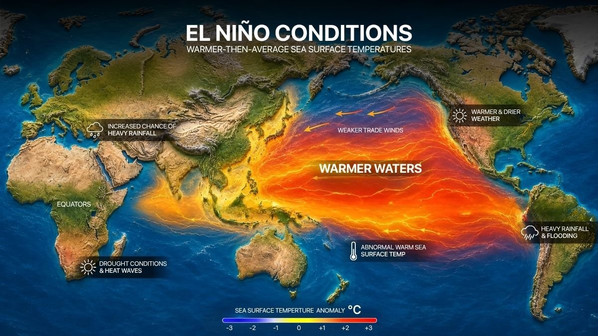
El Niño is a natural climate pattern that shows up every few years when the surface waters of the central and eastern tropical Pacific Ocean run warmer than average. It’s one half of a two-phase cycle scientists call ENSO — the other half being La Niña, its cooler counterpart. Neither phase is a storm or a single weather event; instead, each one nudges the jet stream into a different position for months at a time, which reshapes where storms track, where it rains, and where it stays dry across huge parts of the globe.
“Super El Niño” isn’t an official scientific classification — it’s a term that caught on in weather coverage to describe the strongest tier of these events, generally when ocean temperatures in the benchmark Niño 3.4 region run about 2°C or more above average.
Since 1950, only a small handful of El Niño winters have reached that threshold, which is exactly why this year’s event is getting so much attention.’
How Strong Could the Super El Niño Winter 2026-2027 Really Be?
This is the part that has climate scientists talking. Ocean temperatures in the tropical Pacific have been running close to 2°C above their long-term average since mid-summer 2026, a level that would already qualify as “very strong” if it holds through the season. Federal climate forecasters have placed the odds of this event reaching historic strength at roughly 90 percent for the November-through-January window, with some model runs suggesting it could ultimately surpass the massive 1982-83 and 1997-98 events — two winters still used as the benchmark for how disruptive a Super El Niño can get.
NOAA says El Niño is headed for record-shattering intensity –
For context, only a few El Niño winters since 1950 have ever reached “super” territory: 1972-73, 1982-83, 1991-92, 1997-98, and 2015-16. Each one looked a little different once it actually arrived, which is a useful reminder that a strong signal in the ocean doesn’t guarantee an identical repeat of any past winter — it shifts the odds, not the outcome.
What NOAA’s Outlook Actually Says
The National Oceanic and Atmospheric Administration’s Climate Prediction Center has been updating its probability numbers through the summer, and each update has pushed further toward “very strong.” As of the most recent monthly discussion, the agency’s official synopsis places the chance of a very strong event at more than 90 percent for the fall and winter season. NOAA’s Climate Prediction Center ENSO Diagnostic Discussion –
NOAA’s full seasonal temperature and precipitation outlook — the one most people picture when they think of a “winter forecast,” with the familiar red-and-blue regional maps — typically isn’t released until October, closer to the start of meteorological winter. What forecasters can say already, based on how strong El Niño winters have behaved historically, is which broad patterns tend to repeat:
- The Southern tier of the U.S. — from Southern California through Texas, the Gulf Coast, and into Florida — tends to see a wetter-than-normal winter, with a more active storm track running along the southern jet stream.
- The Pacific Northwest and northern Rockies typically run drier and milder, as the storm track shifts south.
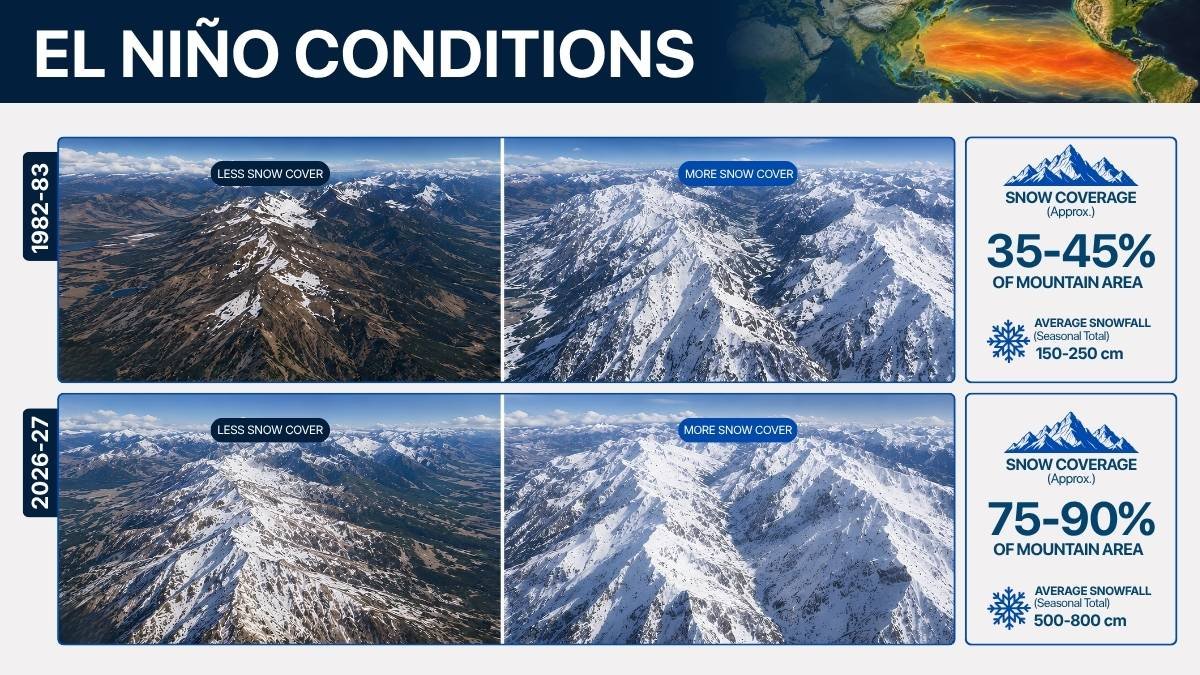
- The Southwest, including the Sierra Nevada, often sees above-average snowpack; some past Super El Niño winters pushed Sierra snowfall to well over 150 percent of normal.
- The Northeast frequently sees fewer of the deep Arctic outbreaks associated with La Niña winters, though this varies more year to year than the southern pattern does.
Why a Strong Signal Doesn’t Mean a Guaranteed Outcome
It’s worth being upfront about something forecasters themselves keep repeating: not every Super El Niño behaves the same way once winter actually arrives. The 1997-98 event brought historic flooding to California, while the 2015-16 event — despite being similarly strong by ocean-temperature measurements — largely spared the state from the same level of impact. Even within the ‘super’ category, the regional outcome is far from certain –
Other factors layered on top of El Niño — like the polar vortex, the Arctic Oscillation, and shorter-term jet stream wobbles — can still shift where individual storms land, even in a winter that’s clearly being steered by a strong El Niño overall. That’s why long-range seasonal outlooks talk in terms of probabilities and tilted odds rather than day-by-day predictions.
What This Means If You’re Planning Ahead
For most households, a strong El Niño winter is less about drama and more about probability. If you live in the southern U.S., it’s a reasonable year to expect more rain than usual and to keep an eye on drainage and storm prep earlier than normal. If you’re in the Pacific Northwest, a milder and drier season than average is more likely, which matters for anyone tracking snowpack, water supply, or ski season planning. And if you’re heading to the mountains of California, Nevada, Utah, or Colorado this winter, the historical odds modestly favor an above-average snow year — though, as with all seasonal outlooks, that’s a lean in the odds, not a promise.
NOAA’s full winter outlook, with region-by-region temperature and precipitation maps, is expected in October 2026. Once it’s released, the general patterns described above should come into much sharper focus.
Frequently Asked Questions
What’s the difference between El Niño and La Niña? They’re opposite phases of the same ocean-atmosphere cycle. El Niño happens when the central and eastern tropical Pacific runs warmer than average; La Niña is the cooler counterpart. Each phase tends to push the jet stream — and therefore winter storm tracks — in a different direction.
When will NOAA release its official 2026-2027 winter outlook? NOAA’s Climate Prediction Center typically releases its full seasonal winter outlook, including the region-by-region temperature and precipitation maps, in mid-October, ahead of the start of meteorological winter on December 1.
Does a Super El Niño affect hurricane season too? Yes — strong El Niño years tend to increase wind shear over the Atlantic, which usually works against hurricane development, while often having the opposite effect on the Eastern Pacific season.
Could the Super El Niño Winter 2026-2027 become the strongest El Niño on record? It’s too early to say for certain, but as of August 2026, several forecasting models place meaningful odds on this event surpassing the 1982-83 and 1997-98 events, which currently rank among the strongest since record-keeping began in 1950.
——————————————————————————————————————————————————-
This article is based on the most recent (August 2026) outlooks from NOAA’s Climate Prediction Center and reporting from national meteorological outlets. Seasonal forecasts are probabilistic and can change as new data comes in through the fall; check NOAA’s Climate Prediction Center directly for the latest official updates.
